6. Information signs
Information signs inform about the location of settlements and other objects, as well as about the established or recommended modes of movement.
6.1 "General maximum speed limits"
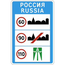
General speed limits established by the Traffic Rules of the Russian Federation.
6.2 "Recommended speed"
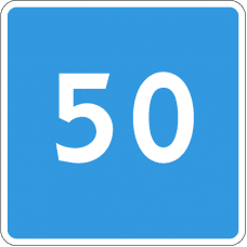
The speed with which it is recommended to travel on this section of the road. The coverage area of the sign extends to the nearest intersection, and when sign 6.2 is used together with a warning sign, it is determined by the length of the dangerous section.
6.3.1 "Place for a U-turn"
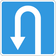
Turning to the left is prohibited.
6.3.2 "U-turn area"
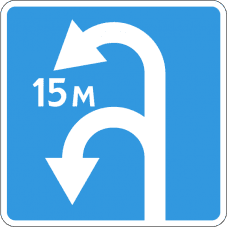
The length of the reversal zone. Turning to the left is prohibited.
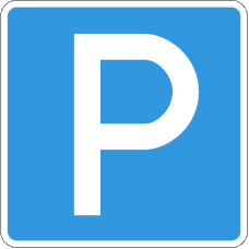
6.4 "Parking (parking space)"
6.5 "Emergency stop lane"
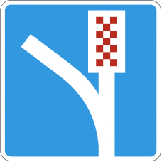
Emergency stop lane on a steep descent.
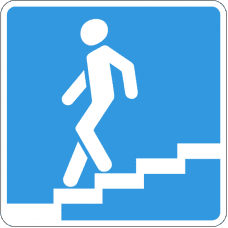
6.6 "Underground pedestrian crossing"
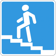
6.7 "Overhead pedestrian crossing"
6.8.1.-6.8.3 "Dead end"
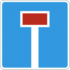
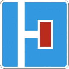
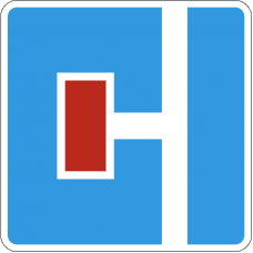
A road that does not have a through passage.
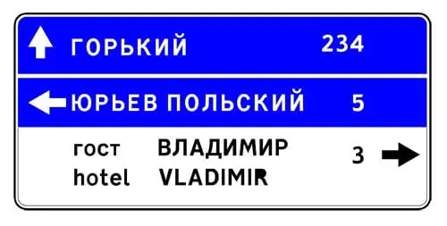
6.9.1 "Advance direction sign"
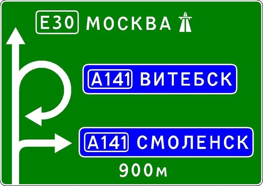
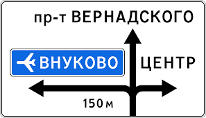
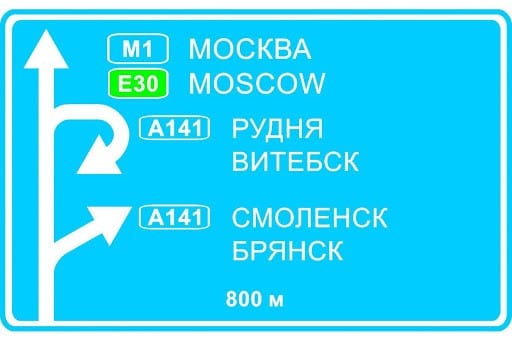
Directions of movement to the settlements and other objects indicated on the sign. Signs may contain images of sign 6.14.1, motorway, airport and other pictograms.
On the sign 6.9.1, images of other signs may be applied, informing about the peculiarities of the movement. At the bottom of sign 6.9.1, the distance from the place of installation of the sign to the intersection or the beginning of the stop lane is indicated.
Sign 6.9.1 is also used to indicate bypassing road sections on which one of the prohibitory signs 3.11-3.15 is installed.
6.9.2 "Advance direction sign"
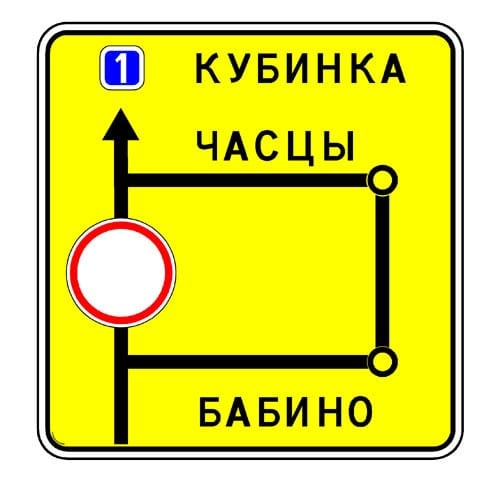
6.9.3 "Traffic scheme"
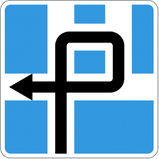
The route of movement when certain maneuvers are prohibited at an intersection or permitted directions of movement at a complex intersection.
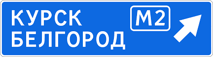
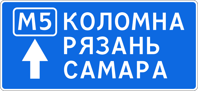
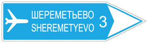
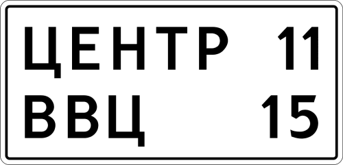
6.10.1 "Direction indicator"
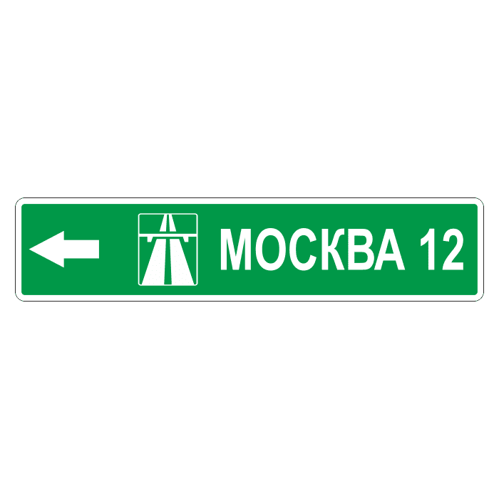
Driving directions to route points. The signs may indicate the distance (km) to the objects indicated on them, symbols of the highway, airport and other pictograms.
6.10.2 "Direction indicator"
6.11 "Object name"


The name of an object other than a settlement (river, lake, pass, landmark, etc.).
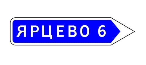
6.12 Distance indicator
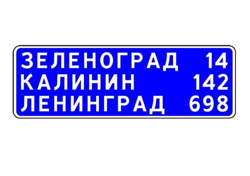
Distance (km) to settlements along the route.
6.13 "Kilometer mark"
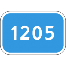
Distance (km) to the beginning or end of the road.
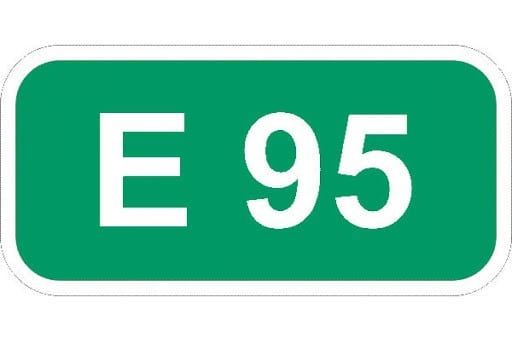

The number assigned to the road (route).
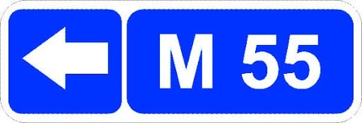
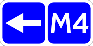
The number and direction of the road (route).
6.15.1-6.15.3 "Driving direction for trucks"
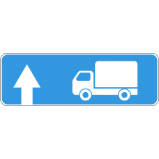
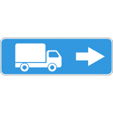
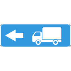
Recommended driving direction for trucks, tractors and self-propelled vehicles, if their movement in one of the directions is prohibited at the intersection.
6.16 "Stop line"
The place where vehicles stop at a prohibitive traffic light (traffic controller).
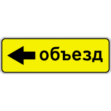
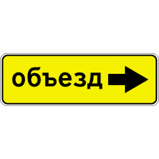
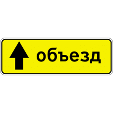
6.17 "Detour scheme"
A detour route for a section of the road that is temporarily closed to traffic.
6.18.1.-6.18.3 "Bypass direction"
Direction of detour of a section of road temporarily closed for traffic
6.19.1.-6.19.2 "Advance indicator of a changeover to another carriageway"
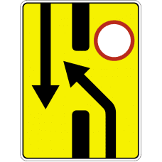
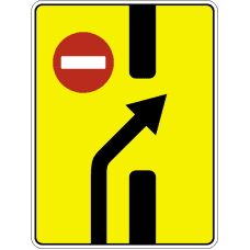
The direction of bypassing a section of the carriageway closed to traffic on a road with a dividing strip or the direction of movement to return to the right carriageway.
6.20.1.-6.20.2 "Emergency exit"
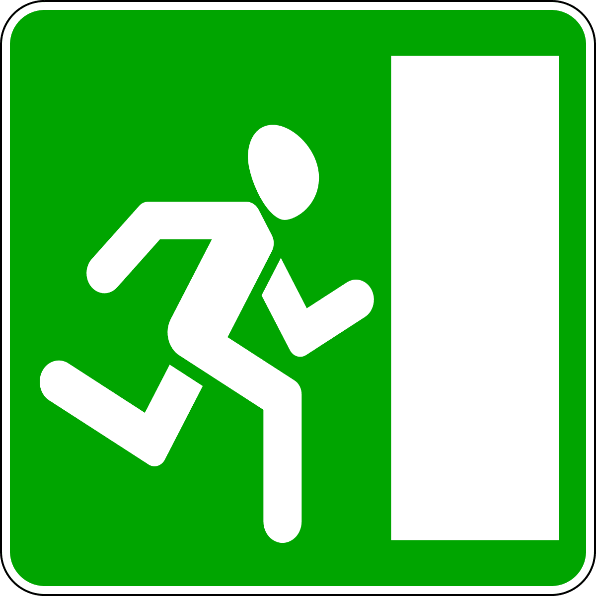
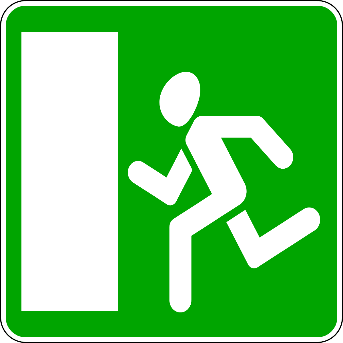
Indicates the location in the tunnel where the emergency exit is.
6.21.1.-6.21.2 "Direction of travel to emergency exit"
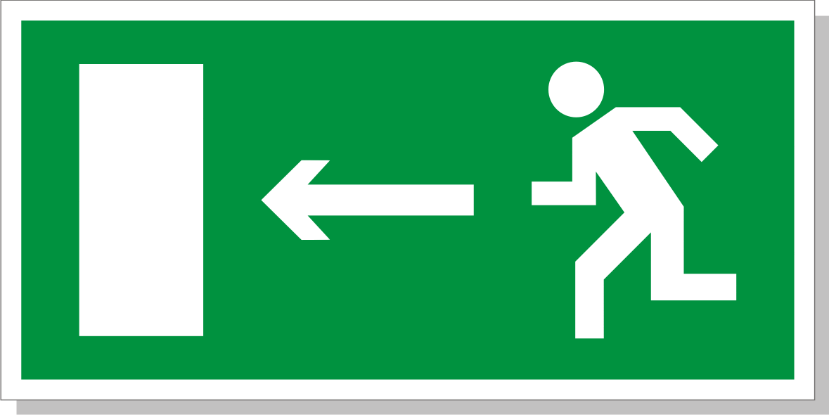
Indicates the direction and distance to the emergency exit.
On signs 6.9.1, 6.9.2, 6.10.1 и 6.10.2installed outside the settlement, a green or blue background means that movement to the indicated settlement or object will be carried out, respectively, along a motorway or other road.
On signs 6.9.1, 6.9.2, 6.10.1 и 6.10.2installed in a settlement, inserts with a green or blue background mean that the movement to the indicated settlement or object after leaving this settlement will be carried out, respectively, along a motorway or other road; the white background of the sign means that the indicated object is located in this settlement.